Why Montezuma Castle National Monument’s Name Gets It All Wrong
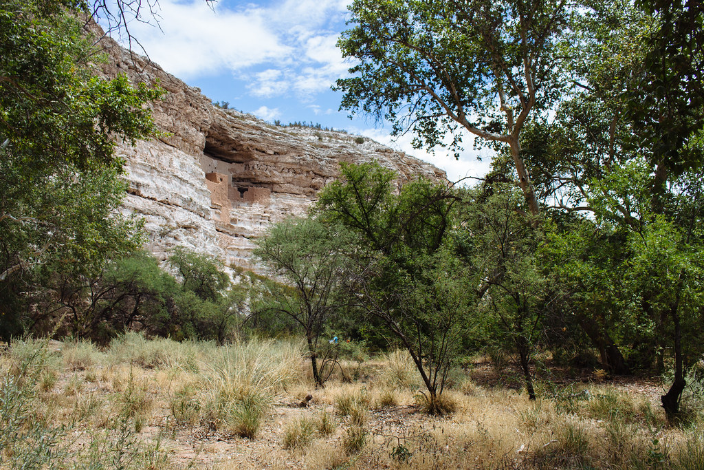
Right off an interstate highway in central Arizona, a national monument protects prehistoric multi-story apartments nestled inside a limestone cliff, old canals that once fed water to crops in the desert, and even a pond where five unique species have evolved.
But everything about the name of this park is just…totally, totally wrong.
Montezuma Castle? More like Sinagua Cliff Dwellings
When clueless Anglo settlers moved into the Verde Valley in the late 1800s and encountered these dwellings, they used the name of an Aztec ruler whose empire stretched across southern Mexico 1,300 miles away. Montezuma’s name, unfortunately, has stuck.
“Sinagua” would be more accurate. It’s the term archaeologists apply to the Indigenous people who lived in central and northern Arizona between around 500 and 1500 CE. The Spanish words for “without water” or “waterless” have been used to refer to these people because they made do with little rainfall, diverting precious few sources of water in the desert to irrigate fields of corn, beans, and squash.
Ironically, the Sinagua people who lived at Montezuma Castle built their abode right above a creek that flooded every year, so I guess you could say they were very much Conagua folks, but I digress.

|
| Montezuma Castle |
No fewer than nine Native American tribes have ties to Montezuma Castle, including the Yavapai people, who historically lived across much of western and central Arizona, as well as the Hopi and Zuni, two Puebloan tribes that many groups from the area joined as they migrated north and east hundreds of years ago.

|
| Verde River Valley |
“Castle” is also a misnomer, as the site wasn’t designed primarily for defense but rather protection from the elements: an elevated perch from the floodplains below. “Cliff dwellings” is much more appropriate.
It’s disappointing that you can’t climb up to them today, making this national monument merely a drive-up, take-the-picture, visit-the-gift-shop kind of park.
But the area had been heavily looted before it was declared a national monument in 1906, and the dwellings were heavily damaged by visitors by the time they were closed off to the public in 1951. You had to climb up the cliff walls via a series of near-vertical ladders, so perhaps this was for the best.
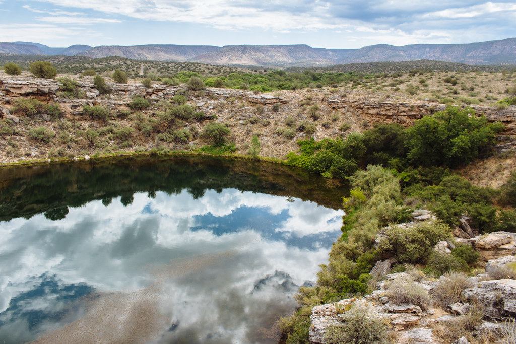
Montezuma Well? Sinagua Sinkhole is more accurate
The Sinagua also made the most of a unique natural feature just upstream along Beaver Creek: Montezuma Well. You can find their dwellings along the rim, set into the sides of the “well,” and along the shore. Plus, you can also trace the route of an old irrigation canal by looking for sediments laid down by the mineral-heavy water.
The “castle” we talked about earlier was built into the towering walls of a limestone cliff, and the composition of the earth here is no different. But here, limestone had dissolved away into a vast cavern—that is, until the roof fell in, turning it into a sinkhole. Natural springs quickly filled up the former cave with calcium carbonate-rich groundwater leached from the surrounding limestone.

|
| Montezuma Well |
The isolated location and water quality of this pond sent evolution into overdrive, and today, five species call Montezuma Well home that are found nowhere else in the world: diatoms (algae), amphipods (tiny crustaceans), leeches, water scorpions, and even snails that have adapted to water with a carbon dioxide content ten times that of most other spring water.

|
| More cliff dwellings |
Visit this unit of the park on a hot, unforgiving Arizona summer day, and you’ll surely be tempted to head down a trail to a cool archaeological site by the water. Shaded by trees, it’s significantly cooler than the rim—plus, it’s situated right next to some bubbling, trickling water. The Sinagua truly knew just where to set up shop. Take a breather down by the water’s edge and marvel at their ingenuity that allowed them to survive in the desert a thousand years ago.

|
| Prickly pear |
How to get there
The Montezuma Castle unit of this national monument is located in central Arizona right off Interstate 17 at exit 289. Once you’re off the highway, turn left at Montezuma Castle Road just past Cliff Castle Casino and continue on to the visitor center.
The Montezuma Well unit is a few miles north on I-17. Take exit 293 and stay on County Road 77—Beaver Creek Road—through the communities of McGuireville and Rimrock. Simply follow the road signs for “Montezuma Well National Monument.”

