How to Time Travel at Petrified Forest National Park
What’s the national park you’ve visited the most in the U.S.? Maybe Grand Canyon, Great Smoky Mountains, or Yosemite?
I have family in Indiana, went to college in Arkansas, and now live in Phoenix, so you might think the park I’ve been to the most is Indiana Dunes, Hot Springs, or Saguaro—and yet I’ve only been to one of those parks (Hot Springs) a single time!
Instead, I’ve passed through Petrified Forest National Park in northern Arizona no fewer than four times in my life, and I’m itching to get back there soon.
|
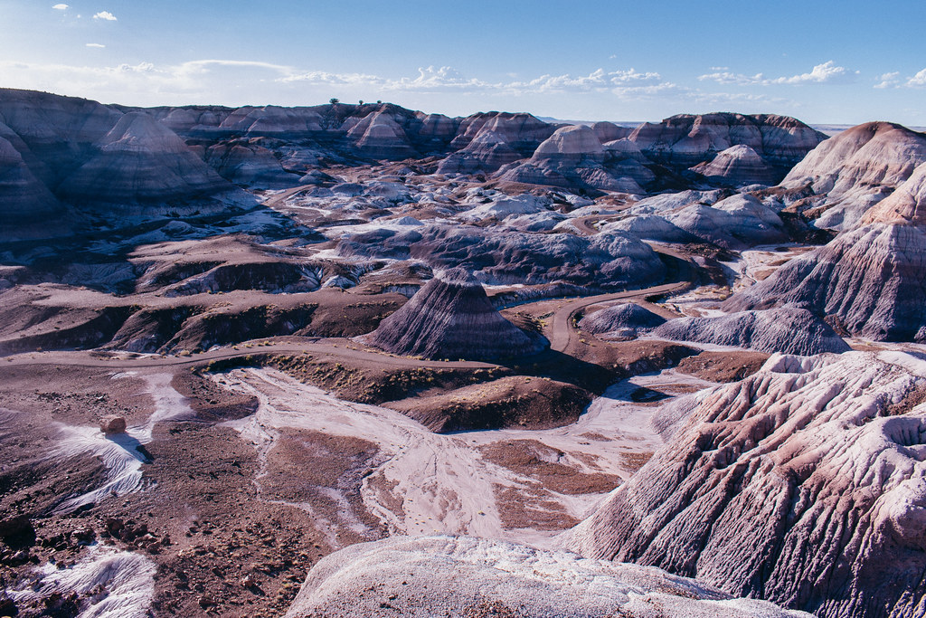
| Blue Mesa Trail |
Although it could be dismissed as just another drive-through experience along historic Route 66 from Chicago to L.A., Petrified Forest is so much more. Yes, this national park guards an amazing collection of petrified wood from millions of years ago, but it also contains stunning badlands, hiking opportunities, and ways to encounter recent (and not-so-recent) Arizona history.
Hop on the park road and you won’t just take a scenic drive around badlands and through grasslands—you’ll also travel back in time.
1960s: Mid-Century Modern
Do you remember all the celebrations for the National Park Service’s 100th anniversary back in 2016? #FindYourPark and all that? Well, they did something similar to coincide with the park service’s 50th anniversary in the ’60s: Mission 66. But instead of a social media campaign, this program made major investments in infrastructure in parks across the nation.
As tourism boomed in the postwar years, aging visitor facilities needed upgrades. Plus, Petrified Forest had just been upgraded from a national monument to full national park status in 1962.
By 1965, a new modernist park headquarters was complete, and it still functions as the northern visitor center today.

|
| Visitor center in the northern part of the park |
1930s: Great Depression
During the Great Depression, the U.S. federal government hired hundreds of thousands of unemployed young men to work on public projects across the country. One such project was improving a crumbling inn made of petrified wood on an old homestead in the Painted Desert.

|
| Painted Desert Inn |
CCC workers completely renovated the inn to align with the Pueblo Revival Style typical of other national parks in the region. The fixed-up structure would function as a hotel for Route 66 tourists in the ’40s and ’50s. Today a museum, it stands at the top of a mesa overlooking the Painted Desert, a good trailhead for exploring the badlands below.

|
| View of the Painted Desert from Painted Desert Inn |
1920s: Route 66
Did you know historic Route 66 passes right through the park? First blazed across the Southwest in the ’20s, former U.S. Highway 66 served migrants and tourists traveling between the Midwest and sunny California. It was decommissioned in 1985 after being supplanted by parallel interstate highways like I-40.
Take the park road south from the Painted Desert and stop just a few hundred yards north of Interstate 40. You can find an old sedan on the side of the road, rusting in the Arizona sun. Posts from old telephone lines still stand along the highway’s original alignment: a phantom Route 66.

|
| Rusting on the roadside |
Mid 1800s: Ungrazed grasslands
There’s not much to see between the Painted Desert to the north and the park’s southern half where the bulk of the petrified wood lies, so you might be tempted to just speed along the park road that links the two units.
Instead, slow down and take in those views all around you: views of almost infinite grasslands blanketing this stretch of the Colorado Plateau. It wasn’t always like this, however.

|
| Open fields |
Cattle have long been one of the foundations of Arizona’s economy—one of the “Five Cs” along with copper mining, citrus production, and others—but in the late 1800s, the territory’s rapacious ranchers had managed to set off an ecological crisis. They let their cattle graze the open range far past its limits, leaving much of the land denuded of native grasses. When a drought was immediately followed by violent El Niño-pattern rain, the remaining topsoil was simply washed away.
Much of the land has since recovered, and here at the national park, you can appreciate a swath of healthy grassland.
1300s: Ancestral Puebloan dwellings
As they did at Wupatki, Walnut Canyon, and Homolovi to the west, Ancestral Puebloan people also lived here along the Puerco River during the 1200s and 1300s. A 100-room complex once supported hundreds of inhabitants who made their living in the high desert by irrigating fields of corn, beans, and squash.

|
| Puerco Pueblo |
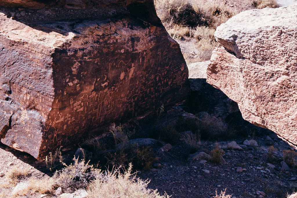
You can see the stone foundations of these dwellings today at Puerco Pueblo or walk up to the railings and look at Newspaper Rock, a massive wall of petroglyphs carved into the desert varnish that develops on the surfaces of rocks in the desert.
|
| Newspaper Rock |
205 MYA: The Painted Desert
You’d be forgiven for accidentally referring to a “Painted Desert National Park” while driving around the northern unit of the park and heading south across the train tracks.
Throughout much of this park, otherworldly badlands seem to bubble up out of the land as rain and wind erode it away. Lollipop stripes of rusty red, smoked-salmon orange, sun-bleached blue, and lavender gray run the perimeters of buttes, gullies, and mesas. They seem so out of place in the otherwise bland grasslands of this corner of Arizona.

|
| Badlands in the Painted Desert |
These badlands are merely the southernmost reaches of the greater Painted Desert, which stretches from the northern edge of the Grand canyon to the southeast in a crescent across the Navajo Nation. The presence of minerals like iron and manganese—and how they interacted with rising and falling groundwater—determines their color today.

|
| My car parked near the Tepees rock formations |
216 MYA: A forest of stone
Continuing south into the heart of the park, you’ll come across its highest concentration of petrified wood. But how did all these trees turn into stone?

|
| Petrified wood along the Blue Mesa Trail |
During the Late Triassic Period, thousands upon thousands of tropical conifer trees died, fell over, and were buried by alluvial sediments rich with silica that prevented the wood from decomposing.
Silica (commonly found in sand and volcanic ash) permeated these waterlogged, uh, logs, replacing the cellulose, cell by cell, until quartz crystals materialized that replicated the size, shape, and texture of the original tree trunks. Hundreds of millions of years later, they emerged from a lush, humid world swimming with fearsome creatures into the dry Painted Desert that very little life calls home today.

|
| “Tree rings” on petrified wood in the Rainbow Forest |
The rainbow-like splashes that replaced monochrome tree rings are dazzling—and tempting. To protect the petrified wood from being carted away by looters, President Teddy Roosevelt declared what is now the southern core of the park a national monument in 1906. It was one of the very first applications of the Antiquities Act, a law that has been critical for the conservation of U.S. public lands ever since.
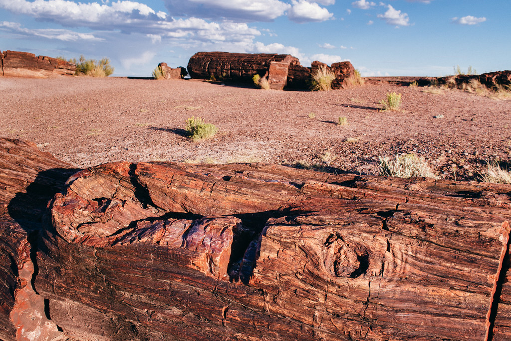
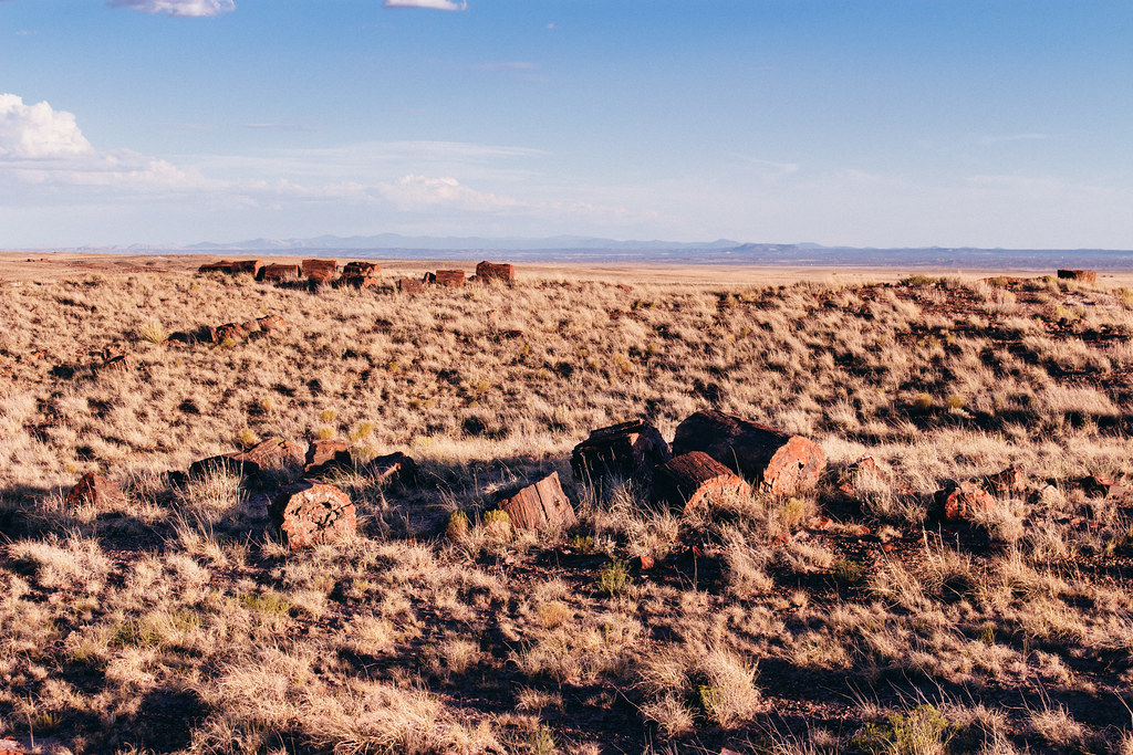
Because of Roosevelt’s proclamation, you can stroll through the Rainbow Forest and take in surreal scenes of fallen trees—the remnants of an old forest—that have been teleported from the very distant past to today. Most trunks have sadly segmented into chunks, but those chunks still remain where they originally emerged from the soil thanks to one president’s foresight a century ago and ongoing vigilance ever since.
|
| Petrified wood in the Rainbow Forest |
You can pause in front of one of these stone logs and imagine an ancient lizard scampering around the tree trunk. Run your fingers around the knots still visible in the “bark” and imagine what kind of critters might have called those long-lost tree limbs home. See the logs still emerging from the earth, unmoved from their original locations since they first toppled over 216 million years ago. Touch the glassy cross-sections of petrified wood and take in the “message in a bottle” sent to you from when the Arizona desert used to be lush and green.
It’s this eerie, tangible connection to our planet’s past that keeps me coming back to Petrified Forest. My most recent visit (in 2018) had me backpacking in the northern wilderness to find Onyx Bridge, a largely intact log that looks like it fell over yesterday. (More about that to come in a future blog post.) I’d love to take a return trip to encounter similarly ancient clam beds in another portion of the park’s wilderness.
With so much to see and do in Arizona and the greater Southwest, I’m not sure when I’ll be back—but I know my travels here will always transport me.
|
| Rainbow Forest |
How to get there
The north entrance to Petrified Forest National Park is 26 miles east of Holbrook, Arizona, on Interstate 40; just take exit 311 and you’ll be greeted by the visitor center and a gas station. The park’s south entrance is also east of Holbrook and can be reached by driving 21 miles along U.S. Route 180 eastbound.
You’ll probably enter the park via one entrance and exit via another if you’re planning on visiting both the northern Painted Desert section and the southern core of the Petrified Forest. So, unless you’re daytripping from Flagstaff and making a loop, make sure to plan out an efficient route beforehand to avoid backtracking or detours.

